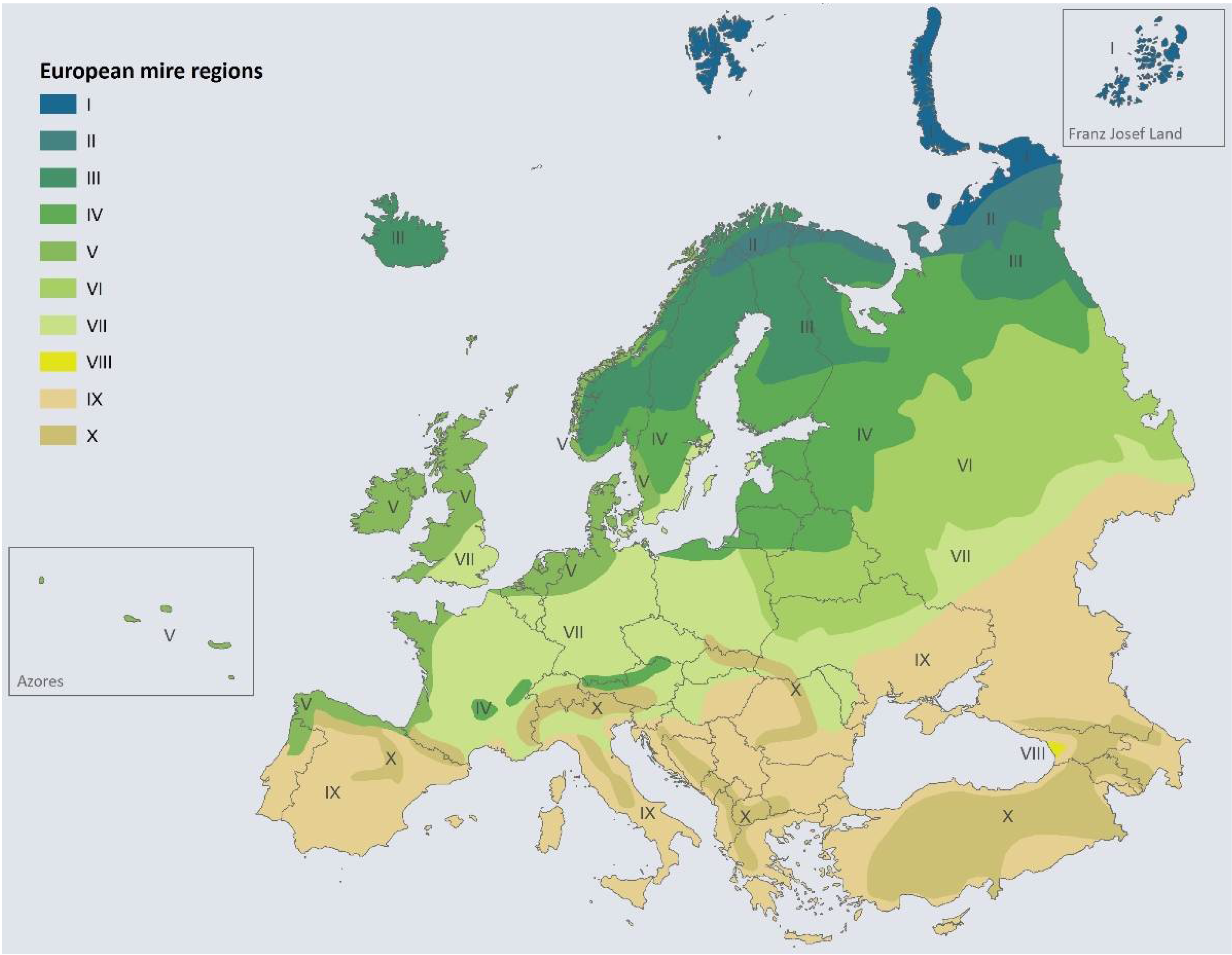
Alexandra Barthelmes, Cosima Tegetmeyer, Hans Joosten, Patrick Scheel: Global Peatland Hotspot Atlas: The State of the World’s Peatlands in Maps. United Nations Environment Programme (2024), ISBN 978-92-807-4197-1, DOI:10.59117/20.500.11822/46635, online, Karten „[…] peatland regionality map“ mit Bezug auf Draft peatland regionality maps for the World, Greifswald Mire Centre (2024), S. 9–10, 12–14. Für Europa aufgrund eines Fehlers (südliche Nordseeküste) stattdessen Karte European mire regions (vereinfacht nach A. Moen, H. Joosten, F. Tanneberger: Mire diversity in Europe: Mire regionality. In Mires and Peatlands of Europe. Status, Distribution and Conservation. Schweizerbart, Stuttgart, 2017; S. 97–150) aus DOI:10.3390/d13080381 verwendet, beide Quellen abgerufen am 9. Februar 2025.
Alexandra Barthelmes, Cosima Tegetmeyer, Hans Joosten, Patrick Scheel: Global Peatland Hotspot Atlas: The State of the World’s Peatlands in Maps. United Nations Environment Programme (2024), ISBN 978-92-807-4197-1, DOI:10.59117/20.500.11822/46635, online, Karten „[…] peatland regionality map“ mit Bezug auf Draft peatland regionality maps for the World, Greifswald Mire Centre (2024), S. 9–10, 12–14. Für Europa aufgrund eines Fehlers (südliche Nordseeküste) stattdessen Karte European mire regions (vereinfacht nach A. Moen, H. Joosten, F. Tanneberger: Mire diversity in Europe: Mire regionality. In Mires and Peatlands of Europe. Status, Distribution and Conservation. Schweizerbart, Stuttgart, 2017; S. 97–150) aus DOI:10.3390/d13080381 verwendet, beide Quellen abgerufen am 9. Februar 2025.
moorwissen.de
M. Sommer, ZALF Müncheberg: Moore in Deutschland. In: Geologische Karte 1:200,000, BGR. 2011, abgerufen am 21. Februar 2025.
nationalgeographic.org
education.nationalgeographic.org
Bog. National Geographic Society, abgerufen am 23. Februar 2025 (englisch).
preventionweb.net
Alexandra Barthelmes, Cosima Tegetmeyer, Hans Joosten, Patrick Scheel: Global Peatland Hotspot Atlas: The State of the World’s Peatlands in Maps. United Nations Environment Programme (2024), ISBN 978-92-807-4197-1, DOI:10.59117/20.500.11822/46635, online, Karten „[…] peatland regionality map“ mit Bezug auf Draft peatland regionality maps for the World, Greifswald Mire Centre (2024), S. 9–10, 12–14. Für Europa aufgrund eines Fehlers (südliche Nordseeküste) stattdessen Karte European mire regions (vereinfacht nach A. Moen, H. Joosten, F. Tanneberger: Mire diversity in Europe: Mire regionality. In Mires and Peatlands of Europe. Status, Distribution and Conservation. Schweizerbart, Stuttgart, 2017; S. 97–150) aus DOI:10.3390/d13080381 verwendet, beide Quellen abgerufen am 9. Februar 2025.
G. M. Steiner: Moortypen. In: Stapfia. Band 85, S. 5–26, zobodat.at [PDF] Zugleich Kataloge der OÖ. Landesmuseen. Neue Serie 35, 2005, Abschnitt Hochmoore, Regenmoore – vom Niederschlagswasser gespeiste Moore. S. 14 ff.