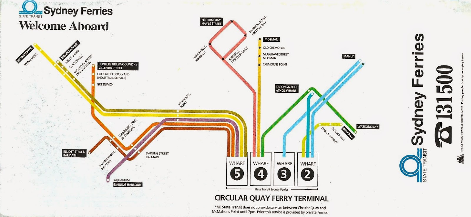
A Sydney Ferries map from 1992 shows Aquarium as the only stop in the Darling Harbour precinct.
Sydney Ferries maps from 1992 and 1995 showed Darling Harbour services, coloured purple, stopping at McMahons Point, Balmain West (Darling Street Balmain) and terminating at Aquarium.
3.bp.blogspot.com
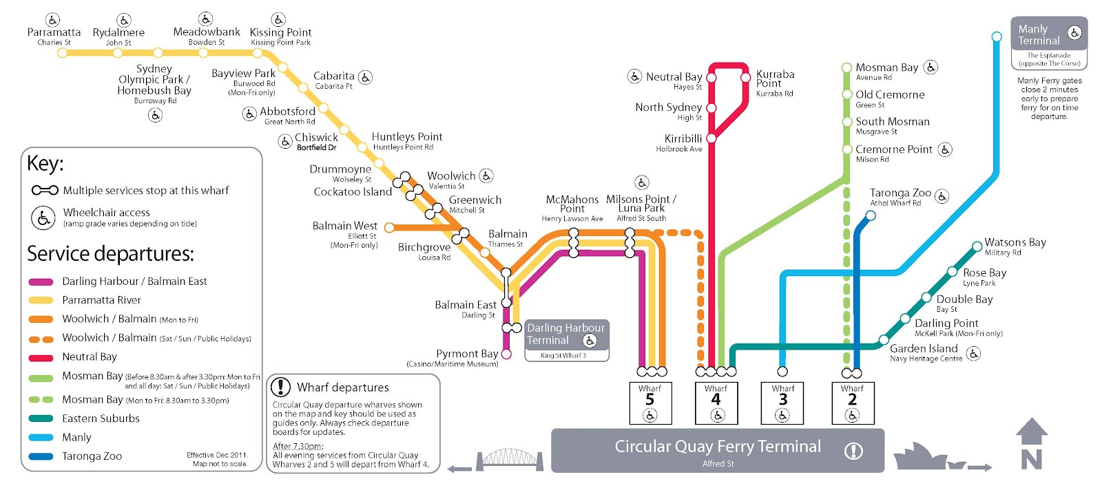
A December 2011 Sydney Ferries map shows that the King Street Wharf was included on the Darling Harbour route. It became the terminus with the 2013 timetable, represented in the 2013 Sydney Ferries map.[4]
An April 2002 Sydney Ferries map shows Milsons Point, Balmain and Pyrmont Bay included on the route, with Pyrmont Bay being the new terminus of the service. Maps based on September 2006 timetables show that this stopping pattern was kept.
Sydney Ferries maps from 1992 and 1995 showed Darling Harbour services, coloured purple, stopping at McMahons Point, Balmain West (Darling Street Balmain) and terminating at Aquarium.
tmserver.com.au
A July 2008 Sydney Ferries map shows the route being split into two, with Balmain and Pyrmont Bay as terminuses and Balmain East as a junction between the two.
An April 2002 Sydney Ferries map shows Milsons Point, Balmain and Pyrmont Bay included on the route, with Pyrmont Bay being the new terminus of the service. Maps based on September 2006 timetables show that this stopping pattern was kept.